Site #298.
We have been working for three days now at Site #298. We still don’t have a modern name for the site, but we are meeting up next week with the muhktar of a nearby town who will probably be able to provide us with a local name. Until then, it is just Site #298. The ancient site was first recorded archaeologically in 2016 by the EPAS team after identifying the location as a possible ancient site via satellite drone imagery.
According to the EPAS surveys, Site #298 was inhabited only in the Iron Age and is just under 2 ha in size. While the Sebittu Project has not yet done any systematic surface survey, we did find a type of jar handle that is often equated with Roman assemblages and a thick piece of colored glass with a thick patina caused by the weathering of exposed glass which may be Islamic in date. Both were in the southern part of Site #298. So, there may be some later deposits here, but a single sherd and glass fragment from the surface are hardly enough evidence to build a strong case. Surveying is a cumulative process and initial assessments are often refined as new information is gathered.
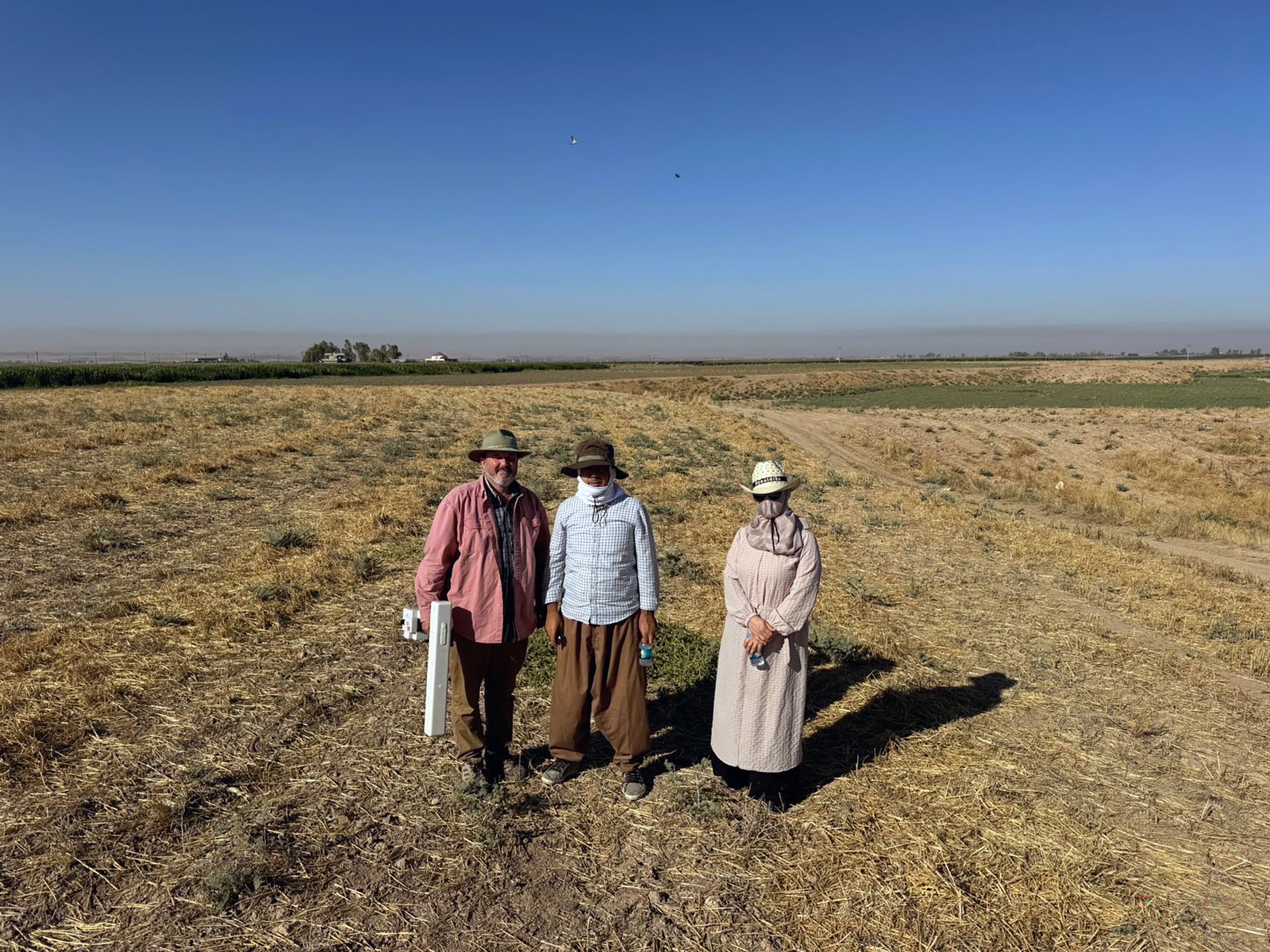
As you can see in this photo, Site #298 is covered in sparse vegetation, a few spiny bushes, the remains of a wheat harvest, and a few willows. These are good conditions for doing survey work as there are few modern constructions and the ground is generally flat.
Site #298 from the south. You can just barely see the ruins of the important Assyrian city of Kilizu (modern Qasr Shemamok) being excavated by a French team. That large mounded site is just behind the modern village on the far left of the photograph.
Our morning routine is to leave the dig house at 4:45am with Bapir, Rafeeq, and I meeting up to take the car on the hour long commute west to Site #298. We pick up Tara at a point near her house in Erbil and, after stopping for hot bread and cold ice (both field necessities), we arrive at the site a few minutes before 6 and immediately set to work.
We are using a hand-held device called a magnetic field gradiometer to measure minute fluctuations in the Earth’s magnetic field caused by features immediately below the ground surface. Our device can map down to about 1.0 – 1.5m in depth (which is called the “shallow subsurface”) and can detect iron ferrous alloy artifacts, burnt materials that contain iron such as clay (so we can find hearths and ovens), and more subtle differences between soil types (e.g., pit fills often have an enhanced magnetic signature due to various human activities). More on that later.
FM-256 gradiometer, me, Rafeeq, and Tara at Site #298. Note that the humans are all dressed for fieldwork in the hot Kurdish sun: hats, long sleeves, as little skin showing as possible. It takes time for visitors to acclimate to working in these conditions.
We lay out 20 m by 20m grid squares on the ground and then carry the machine back and forth across the square at 50cm intervals taking measurements of the earth’s magnetic field. The gradiometer collects the data which is then transferred to a computer where I process the data and map the results. I takes us about an hour to collect one grid square, so there is a lot of walking, and a lot of moving of tapes and ropes to keep us collecting data on the grid.
This is a typical dataset from a 20m x 20m square at Site #298. The white and black features are strong positive or negative magnetic readings. Where we see both a strong positive and strong negative together, we are looking at both ends of a magnet of some type, like in the lower left-hand corner of this image. The large black circle is probably a pit -- ancient or modern is hard to say from this image alone. The smaller black holes are also pits.
We stop mid-morning to have a field breakfast in the shade of the car (those willows are not very shady). These are rough field conditions: the gradiometer case is our table and even by breakfast it is well over 100ºF. Typically breakfast is now warmish bread I mentioned earlier, tomatoes, cucumbers, cheese, and some canned tuna. Tara and Rafeeq sometimes bring treats from home.
Tara, Bapir, and Rafeeq sharing breakfast in the limited shade at Site #298.
Then back to work until the heat gets to be too much. After a number of years of doing survey with this particular gradiometer, I have come to appreciate that it does not collect good data when it gets too hot – and without shade in the field we are in the direct sunlight 100% of the time. I’ve been logging field temperatures and comparing them to data set quality and it seems that over 100ºF there is an increase in noise in our datasets and above 107ºF we have yet to collect any acceptable data. Fortunately for us, the end of the summer heat is in sight and daily temperatures will plunge into the low 90s and the nights get much cooler by the end of next week, which will extend how long we can work. Normally, fieldwork ends between 12:30 and 1:00pm and we head home for lunch and a siesta. Then work in the dighouse on fieldnotes, datasets, report writing, and emails until an early bedtime.


